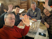
Today was to be the longest-run of the long ride home and, funny, it was. From Alamosa, Colorado to Lincoln, Nebraska took about 12 hours. We learned back in Santa Fe that a stagecoach ride from Missouri to Santa Fe took two months. Imagine what this little trek would've taken.
We also learned that back when Spain controlled what is now New Mexico, the King sent word to his forces that someone had taken up residence in the Nebraska territory and sent an expedition up to find out who. From what I can tell from the ride across America's feedlot, it's someone who didn't know any better and trust me, king of Spain, you didn't want Nebraska anyway.
Say, let's have a contest between states.
You go first, Colorado, with your gorgeous Spanish Peaks:
Your turn, Nebraska. Give us all you've got!
We miss you already, Desert Southwest. You've given me new motivation to get the airplane finished and flying.
Update - 3/25 Total miles driven on the trip: 4,312.4
Monday, March 22, 2010
Sunday, March 21, 2010
Taking a pass through Colorado
From time to time on this trip, I've found myself thinking, "how would I fly here when the RV-7A is done?" The trip back home began today in Williams, Arizona this morning and we've circled the wagons and are making camp in Alamosa, Colorado for the night. About an hour or so ago, I found myself thinking "find another route for the RV-7A" when we got to the Wolf Creek Pass between here and Durango.
By the way, that's another part of the trip that's been intriguing. There's wide-open sky everywhere, and I've seen one small plane in it on the entire trip.
Anyway, we wound our way up through the pass about 10,000 feet over 8 miles, and then back down again over 8 miles. This winds us through the San Juan Mountains, where the Rio Grande River comes out into the open for the first time on its journey.
As with the rest of the trip, it has been remarkable to see the difference in geography and geology over a relatively short distance.
Over our 500 miles today, we started by driving across the desert of the Navajo and Hopi lands.
We passed several high schools on the reservations and were shocked -- to the say the least -- that several of them had nicknames -- including Redskins -- that we would consider racially insensitive.
A little farther along we'd pass some mesa, with snow-covered mountains off in the distance...
I never did put the odometer on these to see exactly how far away they were but 100 miles is not out of the question. And eventually, we'd get to them, go over them, and go down to the desert floor again on the other side.
Unfortunately, the Four Corners Monument was closed for construction. That's where Arizona, New Mexico, Utah, and Colorado meet. We had no choice but to push on for lunch at an out-of-the-way lunch spot in Cortez, Colorado which featured old video of America concerts from the '70s. I don't really understand Colorado.
A few miles ago we passed a grain elevator with Bush/Cheney '14 painted on one side and McCain/Palin on the other. Mostly, though, the very diverse politics of the southwest has been hidden. For example, I've seen almost no bumper stickers on the entire 3,000 mile trip, at least not since I left Minnesota.
What does this mean? I think the southwest is quicker to "let it go" than Minnesota is.
Saturday, March 20, 2010
Hanging at the Grand Canyon
The Trophy Wife and I spent the day at the Grand Canyon today, a reminder to all homeowners to make sure the downspout properly drains away from the house, lest you have some serious landscaping problems in 140 million years.
No camera can do the Grand Canyon justice, so we'll just go with the usual shots. Humor me.
Tomorrow morning we'll do something we haven't done in about 9 days -- turn the car toward the northeast.
Friday, March 19, 2010
From Tucson to the Grand Canyon
Today we said "goodbye" to Tucson, the southernmost stop on our exploration, but not before taking a scenic drive along the foothills.
Then we again raced across the desert, back to Phoenix, and up into the high country.
We stopped in Rock Springs, which was famous as a stagecoach and watering stop. The place we stopped at claimed Waylon Jennings and Marty Robbins were known to write songs in the saloon.
The food was excellent, though we recommend if you plan to go, plan on stopping before you're actually hungry so that by the time the food comes, you'll be starving.
A few miles north, we left the interstate and got on the scenic road up to Sedona. We stopped for the view, not knowing that it gets better. (No, I've never actually been to Nantucket)
A lot better (click to enlarge any of these images)...
This is just outside Sedona. They should call this stretch the "Oh My Highway" because around every turn there awaits another spectacle that forces you to exclaim, "Oh, my!"
I suppose people who live here get used to it, which is unfortunate.
You can see the cactus of the desert has given way to some tree growth and, of course, the rock is red.
Sedona itself is a way-too-precious-for-its-own-good town that apparently fell victim to too many community orgasms at the sight of a Lexus with California plates, but shortly past it, the rock turns white, the red disappears, and the snow appears as we approach 7,000 feet.
The water is rushing fast from the winter melt in the canyon. The desert has given way to pine forest.
I couldn't tell whether the sound I heard in the canyon below was the wind, or the rushing water. I finally settled on it being the water. And, of course, it was quite windy and the jackets came out.
I took enough pictures here to make one of those panorama-type things but the program I used to make it - ClevrStitcher - has become DumbAsAGoddamPostStitcher in the last few days.
We've now made it to Williams, Arizona. The wind is howling, the temperature is 43, and tomorrow we'll head for the Grand Canyon.
Thursday, March 18, 2010
Dinner in Tucson
These are some of my favorite people in the world, so today we drove down to Tucson to have dinner with them. This is the Brasch family -- that's Carol and Michael. You can't see Glenn, because he's taking the picture.
Glenn and Michael come up to Oshkosh every summer for AirVenture, and I probably would stop going over if they -- and Darwin Barrie (who we had dinner with the other night in Phoenix) -- didn't.
Glenn and Darwin are real pilots. They fly medivac helicopters for a living after completing their law enforcement careers. That's "real pilots" as in instrument-rated helicopter pilots. (I also linked to a story Glenn wrote about his Young Eagle flights here)
We had a great dinner at a fine choice of a restaurant. I'm ready for Oshkosh!
Is Arizona in Minnesota's future? Probably.
(Tucson) -- Arizona, as we've come to discover in the last three or four days, is a gorgeous state with an ugly disposition. I've documented the former, the latter is a story you've heard before -- the effects of a $2 billion state budget deficit.
Like Minnesota, the Republican conservatives are screaming about no new taxes. Maybe they're right; maybe the state is wasting taxpayer money. It's naive to think states don't. And, no doubt, there are people gaming the system. But it also requires one to define waste by health care for poor children, which is being cut. Or a GED program for teens, which is no more. Voters are being asked to rescind an 80-cent-a-pack tax on cigarettes which was dedicated, I believe, to early childhood development programs. Like Minnesota, the money was dedicated so ideologues couldn't get their hands on the money. If the voters disapprove of the tax they already approved, the tax will stay but the money will be swept into the state's General Fund. You think that money is going to be spent on early childhood education? This is how lawmakers define waste.
There's also an income tax cut being kicked around while this is going on, with most of the money being saved by the very wealthy. Earlier this week, we visited a pal who lives on a private, gated airpark. There were million dollar homes with attached hangars containing Citation jets and helicopters (in the same hangar). Drive around Phoenix and you see plenty of Cadillac SUVs.
No doubt there are people of means struggling with a lousy economy; recessions are like that. I don't pretend to know much about Arizona, having spent only a few days here. But you can live anywhere in America now and feel the same twisted vibe. Moral bankruptcy usually follows the financial kind. We solve our education problem by guaranteeing a more uneducated population. We solve the health care problem by creating more sick people. We address poverty by assuring it grows. No doubt a lot of people are gaming the system. But that doesn't make the approach logical.
On one of the airplane lists I follow on the Internet, a current thread was started by someone looking for a place with lower taxes than California. And people in various parts of the country are writing with suggestions while acknowledging their tax situation is out of control.
Again, maybe it is. Or maybe they've just all gotten their kids through the taxpayer-paid public school system, maybe even had them educated at a public university, are living off their public pensions, or their private pension from their job with a private company that got fat off government contracts, with their education paid for by the GI bill.
In any case, they've got theirs and got where they are without the help of the guvmint. It's the job of others to make it on their own.
Oh, and they don't want to live just anywhere where the taxes are low. They want a 'quality of life' to go with it.
This is the way it in this country right now. We'll ask our children to die in a desert in Iraq or Afghanistan so the people can have a better life there, but in this desert, you'll need to pee behind a cactus if you have to and hope your kid doesn't (a) get sick or (b) need to compete in an international economy with an education.
We've seen an incredible cross-section of American geography in the last week and there's more to go. But everywhere we visit, we also see and hear the refrain of the American. "I've got mine." At a time when people are invoking the Minutemen and other images of our glorious battlefields past, I just can't square dead people on Omaha Beach with the country that's fast becoming one hell of a son of a bitch.
Wednesday, March 17, 2010
A walk in the desert
Our Minnesota Landscape Arboretum membership entitled us to free entry to Phoenix's Desert Botanical Garden, which was our destination today. It was 83 degrees in the Valley of the Sun -- gorgeous weather.
This critter -- Texas Mountain Laurel -- smells like grape candy and as you walk through the trails, when the breeze is just right, you get a whiff of grape.
At the entrance, this is a glass sculpture. I haven't played with the color settings on this at all. Look at the color of that sky!
But there was plenty of the real thing.
I took this one to give me some ideas for the backyard, you know... what with climate change and all.
The only frantic moment was after we took the picture at the top of the post, Carolie realized a little later that she'd forgotten her backpack/purse. We raced back to the spot, but it was gone. Fortunately, someone had found it and turned it in and the two were reunited. Big points again for you, Desert Southwest.
Happy hour by the pool while waiting for a load of laundry to finish.
Click the image below to go to the album and then click "slideshow."
A walk in the desert |
Tuesday, March 16, 2010
A day at the ballgame
We went over to the ballpark at Goodyear -- about 2 miles from where we're staying -- for the Indians-Giants Cactus League game today. The Indians share a spring training complex with the Cincinnati Reds. I ordered tickets ahead of time but I didn't need to. However, it did put me in the 2nd row behind thirdbase. (As always, click the image for the full-sized version)
Got a chance to see Bob Feller:
Travis Hafner whacked a double to open up the game in the mid-innings. With Jake Westbrook turning in four solid innings and Hafner smacking the ball around a fair amount, there's hope in Cleveland.
Left field's home run porch is a lawn where you can spread out. If we go to a game tomorrow evening (a day-night doubleheader with the Brewers in the day and Reds at night, I believe), maybe we'll lean up against a palm tree and watch the game.
Off the first and third base lines, there's a bunch of grass where people can play catch during the game.
You know how at the old Metrodome the kids could run the bases after the game? In Arizona, it's a different demographic.
Outside the ballpark, this is the signature sculpture. I'm not sure what it's supposed to be. Is it a baseball to look like a feather?
The view from the not-cheap seats:
Final score: Indians 7 Giants 1.
We're coming for you, Twins!
I told Carolie this is my spring training to get ready for Oshkosh. I have to build up to being able to sit out in the piercing sunshine for seven or eight hours at a time. I'm not there yet. Speaking of Oshkosh, we're off to Chandler this evening to take Darwin Barrie -- RV builder/flyer and Oshkosh bud -- out to dinner.
Salt River Canyon - Arizona
Reaching Phoenix
Breathtaking does not do justice to the diversity of the scenery that we encountered on today's Santa Fe (New Mexico) to Goodyear (Arizona) leg of our let's-get-out-of-Minnesota-and-go-watch-some-spring-training trip. As with all the images, if you don't click on it to get the bigger version, you're really missing out. "It's like riding through a postcard," Carolie said. She's right. Over every hill, there awaits quite a spectacle.
We started out in Santa Fe with the remnants of yesterday's snowstorm...
An hour later we were in Albuquerque.Somewhere atop this mountain, there is a tram and a restaurant where we were originally going to have lunch. But we decided to wait a few hours to get started today in order to let the roads clear and there were clouds anyway.
So we turned west in Albuquerque and headed toward Gallup, New Mexico.
It was a wide-open expanse. We stopped in at a Post Office to mail some postcards on one of the reservations and got back on the road for Gallup, where we hopped on route 66 for a bit. Gallup, to be clear, sucks. But the gateway to Arizona more than makes up for it.
I would have thought this the highlight of the day. Standing in the middle of the road, with nobody around, looking across the desert floor near Springerville, Arizona.
We'd gotten off the interstate and decided to take the scenic route, at the recommendation of my Tucson friend, Glenn Brasch. This wasn't even labeled the scenic route on the atlas. I wish I didn't have constant ringing in my ears (left over from the onset of Meniere's Disease), because otherwise I'd have been able to experience absolute quiet. Not even the wind.
Those mountains are 40 miles away -- the White Mountains of Arizona. I had no idea there was such a thing.
So an hour or so later, we were in the Apache National Forest with massive snow drifts on one side, dozens of miles of forest (and one huge ski area). This could've been southern New Hampshire. This shot was taken as we navigated on the down side.
Elevation here was over 7,000 feet.
An hour after that, we were in the Salt River Canyon. I'd hoped to stitch together another panorama shot, but the Internet connection is really terrible here at the motel, so I may have to wait until later.
Here's a sample:
The river is, obviously, way below.
"Let's see the Grand Canyon beat this," I said to Carolie as we got back in the car. The wind was howling through the canyon and it was quite cold.
We lost the sunlight shortly thereafter and we had another three hours of driving. We probably could've spent three fewer hours on the road, but we would've missed this.
It was weird seeing a sign for Los Angeles on the highway, but we've reached out westernmost destination on the trip (actually, the Grand Canyon might be a little farther West).
We'll stop here for three days. Tomorrow, or I guess it's today, we'll sit behind the dugout at the ballpark here in Goodyear and watch the Cleveland Indians take on the San Francisco Giants.
The Indians have the best record in spring training so far. Driving 1,900 miles to watch an Indians game was probably the only way these days to see the squad while they're still in first place in some league, even if it doesn't matter.
Subscribe to:
Posts (Atom)